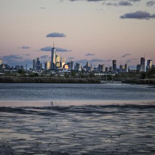
Rising Tide: New York and the East Coast
The East Coast of the United States is particularly vulnerable to rising sea levels. The Atlantic Ocean’s waves and currents, along with storms like hurricanes, blizzards, and Nor’easters, propel water into the shoreline. Meanwhile, areas along the already low coast are sinking; construction over drained wetlands means that cities have lost a buffer between land and sea; and in places like Miami the porous geology means that water also rises from below.
In New York City, sea level rise means that many low-lying areas are already experiencing regular flooding at high tide, even in good weather. Storms can bring catastrophic flooding, with wave-driven seawater joining rainwater to inundate streets, buildings, and infrastructure such as power plants and subway tunnels. In 2012, Superstorm Sandy caused the death of 44 people and $19 billion in damages in the five boroughs alone.
New York, New York

2018
With houses built right on the coastline at Breezy Point, the Rockaways were hit hard by Superstorm Sandy in 2012 and are still vulnerable nine years later.

Breezy Point, Rockaway, New York
2018
Schoolchildren planting to prevent soil erosion in Jamaica Bay.
Miami, Florida

2014
During king tide, the highest predicted tide of the year, in Miami Beach the water comes up over a poorly maintained seawall and through the drainage system into the street. But even well-built seawalls cannot prevent another source of flooding: water seeping through the porous limestone on which the city is built.
Rising Tide: Introduction
About the exhibition Rising Tide: Visualizing the Human Costs of the Climate Crisis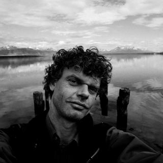
Rising Tide: Artist's Statement
A message from photographer and filmmaker Kadir van Lohuizen.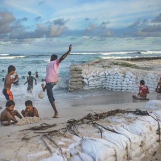
Rising Tide: Worldwide
Witness the dramatic impact of the climate crisis around the world.